Plan the ultimate adventure between mesmerizing natural landmarks with this Arches National Park map.
Arches National Park stretches over a whopping 29,706 hectares, boasting more than 2000 natural arches across countless hikes. And, while these quirky rock formations are the main draw, there are so many reasons to visit the park.
But with so much to see, you’ll want to narrow it down to the top attractions in Arches National Park. And you can do precisely that with this handy interactive map we’ve made.
Top Tip: Once you have your map handy, read about the best things to do in Arches for an unforgettable vacation.
Arches National Park Maps
Interactive Arches National Park Utah Map
The park highlights include scenic drives, thrilling hikes, and unique viewpoints.
You’ll find all this – and a few surprise inclusions – on this handy interactive map. So before you grab your water bottle and hit the trails, grab this all-you-need map.
Printable Arches National Park Trails Map
We all know how dodgy phone battery can be, so purchase this Arches National Park hiking map as a backup. Although we recommend following our interactive map, technology sometimes bugs out, so the printed version is always helpful.
Sights Featured on the Map of the Arches National Park
A little more information on the places featured on the Arches map.
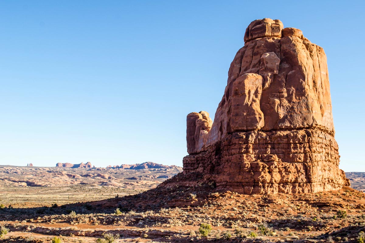
Arches Scenic Drive

Enjoy unforgettable views of the park on the 19-mile drive along Highway 191. It takes half an hour to complete the drive, but we recommend exploring for at least four hours.
The top viewpoints include Courthouse Towers and Balanced Rock, with the road ending at Devils Garden. And you can enjoy all the views again as you drive back to the park entrance.
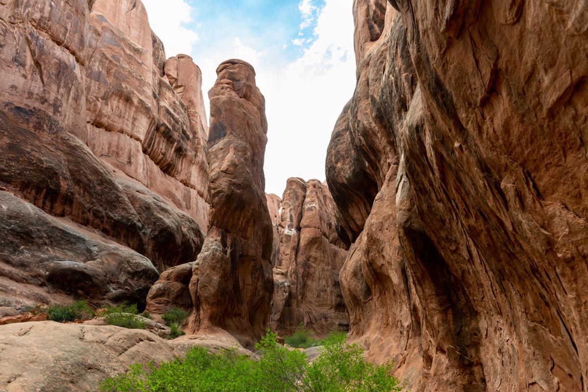
Park Avenue
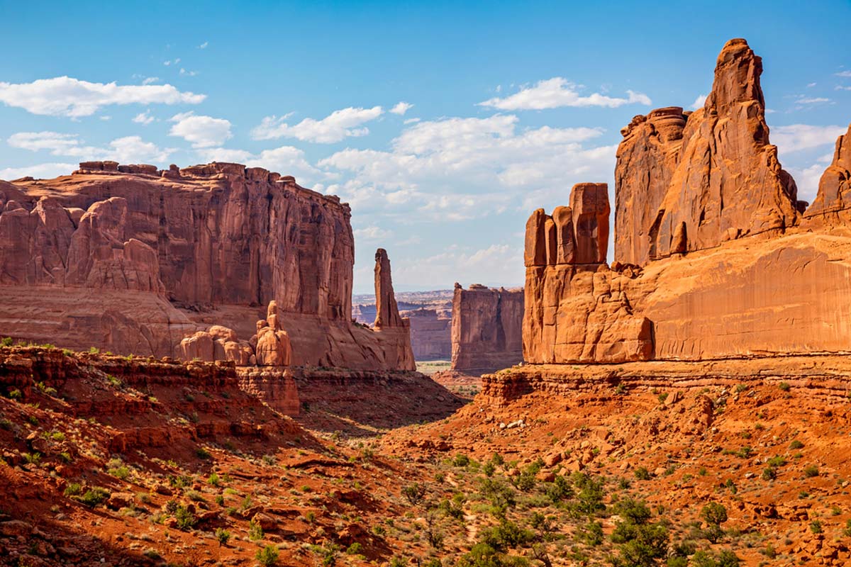
For breathtaking views of sheer canyon walls that look similar to an alligator’s tail, go to Park Avenues Viewpoint. It’s a short walk from the parking area, and once you reach the viewpoint, you can admire the surreal terracotta-colored landscape.
There’s a short two-mile out-and-back trail that meanders through the canyons, and you can get up close to iconic landmarks like Sausage Rock (what a name!). At the end of the route, you’ll reach the Courthouse towers viewpoint.
Top Tip: For something other than arches, hike the 0.8-mile Courthouse Wash Panel Trail. You’ll be able to see 4,000-year-old pictographs.
La Sal Mountains Viewpoint
No more than a 5-minute drive from Park Avenue is the La Sal Mountains Viewpoint. Although no arches are in sight, you’ll have mesmerizing views of the towering canyon walls and La Sal Mountains dominating the background.
We recommend you visit this viewpoint when entering and leaving the park. This way, you can capture breathtaking photos with morning and afternoon lighting.
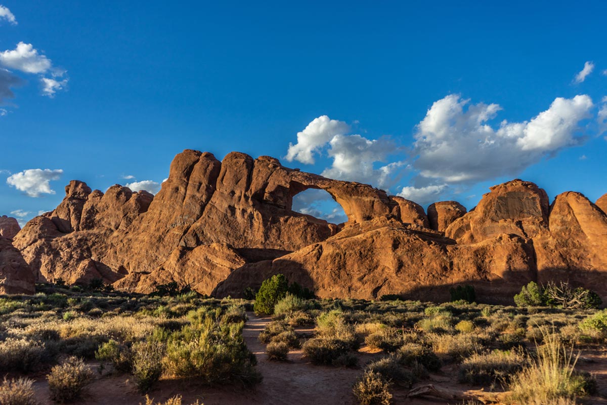
Windows Viewpoint Trail
Take a short 45-minute hike (0.7 miles) to the unusual Windows arches. The North Window Arch and South Window Arch create something that – from the viewpoint – looks a lot like E.T.
The arches form eyes with the towering rock in between making a nose. And that’s not all, because if you carry along the Spur Trail, you’ll reach the giant Turret Arch.
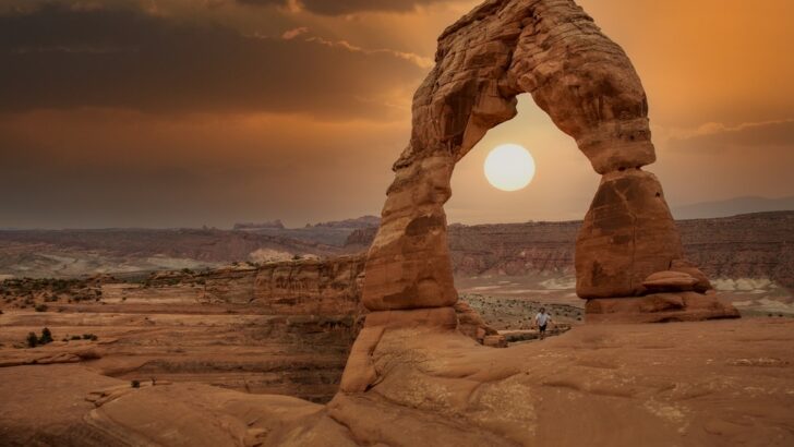
Delicate Arch Hike
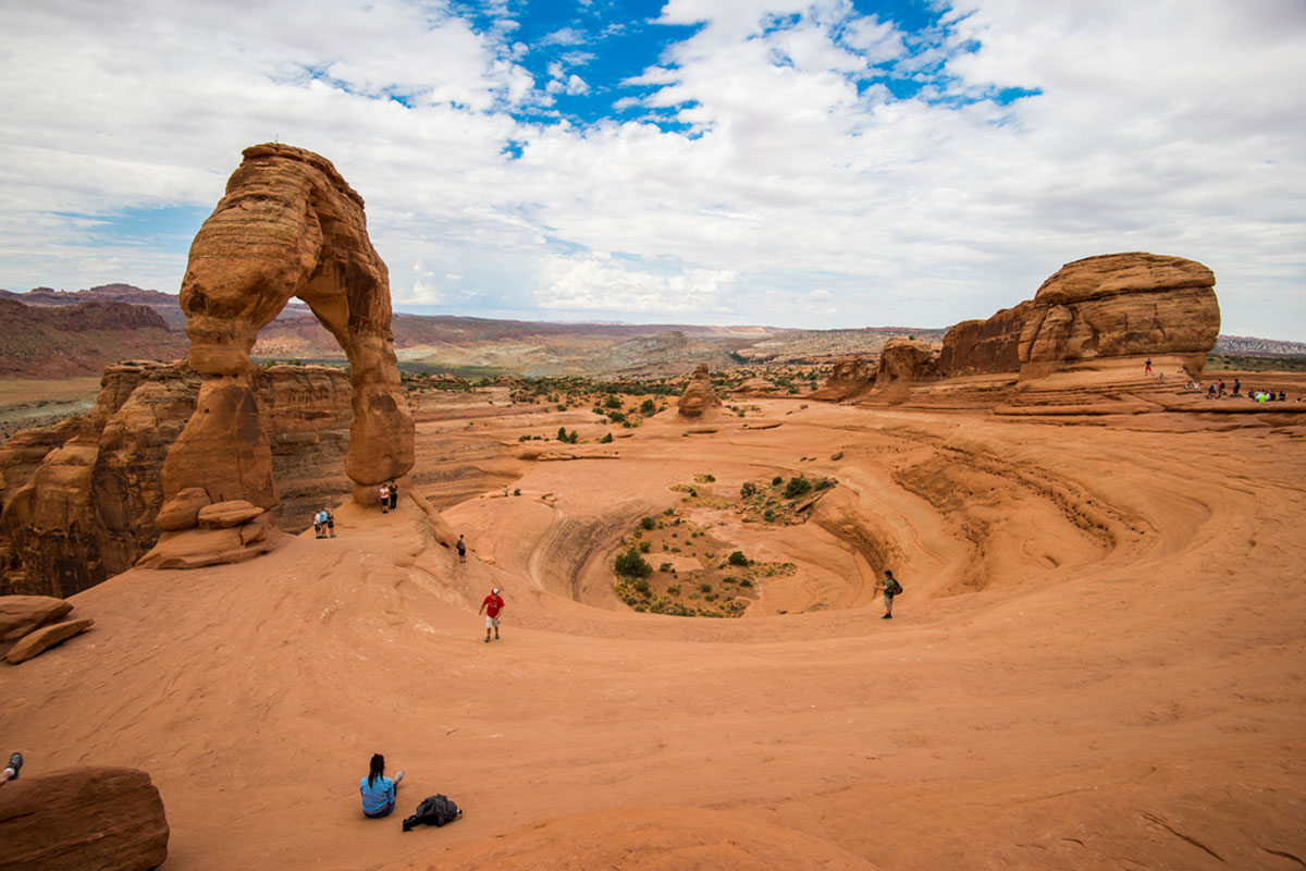
One of the most iconic things to do in the park is the 2-hour hike (3 miles) to Delicate Arch. During this out-and-back trek, there’s an elevation gain of 480 feet, so it’s a relatively moderate hike.
You can admire breathtaking views of the valley below – especially on a short section with a sheer drop to your right. Although this may be daunting, it’s well worth the effort, as the Delicate Arch viewpoint is something you’ll never forget.
Top Tip: Visit at sunrise or sunset to snap a majestic photo of Turret Arch through North Window Arch.
Fiery Furnace
Discover the reddish tint that dominates this archless region of the park.
You can view Fiery Furnace at the viewpoint, but we suggest joining a challenging but epic 2-mile ranger-led hike, where you’ll meander between fin-like canyon walls.
Devils Garden and Landscape Arch
In Devils Garden, you can join either the Landscape Arch trail (1.6 miles) or the longer Double O Arch trail (4.3 miles). No matter which track you choose, you’ll see mesmerizing landmarks such as Pine Tree Arch, Tunnel Arch, and Najavo Arch.
But, we’ll be honest, the star of the show is Landscape Arch. It’s 306 feet long, dominating Devils Garden, and is the longest natural arch in the world.
Maps of Arches National Park: Practical Tips
- Many areas in the park have little to no signal, so be sure to save it as an interactive offline map.
- If you plan on spending several days exploring Arches but want to avoid camping, consider getting an America the Beautiful Pass. You’ll be able to explore the park without paying entrance fees each day. It will also work for all of Utah’s National Parks.