
The ultimate Salt Lake City hiking guide. Discover 15 incredible hikes to add to your SLC itinerary.
Planning a hiking trip to Salt Lake City? Or, just fancy spending the day immersed in nature? You’ve come to the right place. We’ve got the low down on the best hikes in Salt Lake City.
The capital of Utah sees more than 120 million visitors each year – many of these flock to experience sunny skies, stunning landscapes, and endless opportunities for outdoor adventure.
Hiking is one of the most popular outdoor activities in SLC. As long as you have proper gear, you can enjoy hiking throughout the entire year. There are more than 300 miles of hiking trails with over 40 designated and named trails throughout the SLC area.
Pretty impressive, we think.
Ready to plan your own adventure? Keep reading to discover the best hikes in Salt Lake City…
Best Hikes in Salt Lake City
Lake Mary Trail
Length: 2.6 miles
Time: 1 hour 45 minutes
Difficulty: Moderate
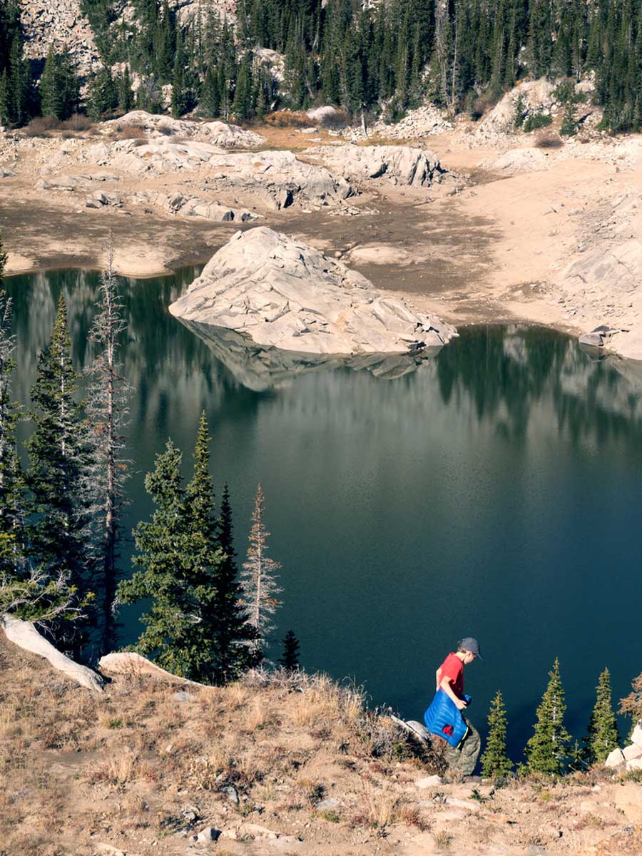
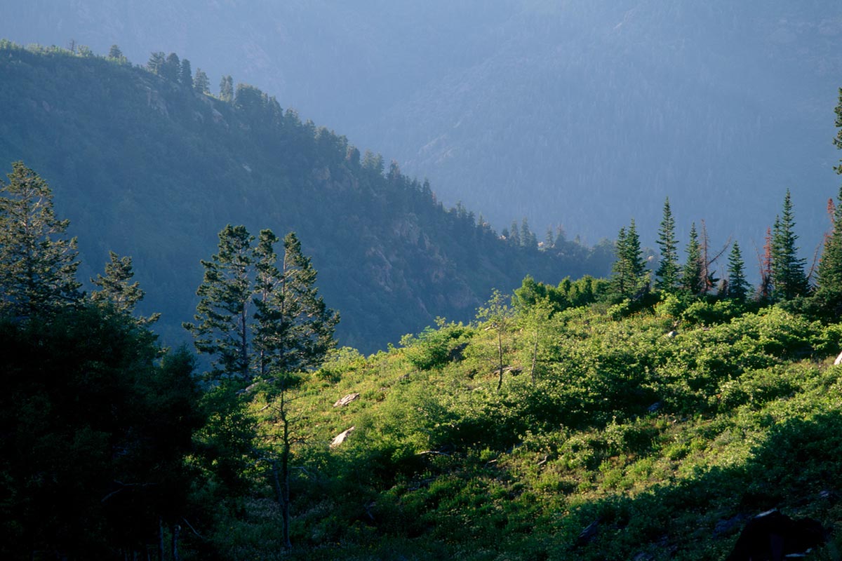
First up: Our favourite Salt Lake City trail. The Lake Mary Trail is an out-and-back trail generally considered to be moderate in difficulty.
Located in the Uinta-Wasatch-Cache National Forest, this hike is popular all year long, though it’s most heavily traveled from January through October. The trail is not always clearly marked so downloading a map or having a backup GPS is recommended.
This trailhead is at the Brighton Ski Resort where you can park in the lot and then follow the signs for Lake Catherine. FYI, Lake Mary is the first lake along this trail followed by Lake Martha then Lake Catherine. While you can’t swim in any of the lakes, the views are worth it.
During the winter months, this trail crosses potential avalanche terrain so it’s important to be aware of triggers and what to do if one were to happen. It is one of the best winter hikes in Salt Lake City.
Cecret Lake Trail
Length: 1.8 miles
Time: About 1 hour
Difficulty: Moderate
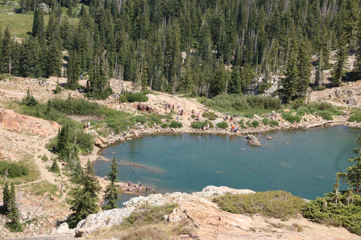
For one of the best hikes near Salt Lake City, check out Cecret Lake Trail (no, we promise this isn’t a typo).
This out-and-back trail leads to a gorgeous alpine lake. And, while the lake is occasionally drained, stunning mountain views are pretty much always guaranteed.
The hike is fairly easy, which means that it’s a popular route. This does mean that the parking lot can get quite crowded so getting there early is recommended. If you’re a little bit worries about finding a space, there’s also the option of parking in the Albion base area and using Upper Albion Meadows Trail to access Cecret Lake Trail.
June through September are the most popular months to hike this trail but many people use it all year long. As with other hikes on this list, if you’re hiking in winter, be aware of the avalanche conditions.
The trail can be steep and rocky at times but is suitable for children, however, dogs are not allowed on this trail.
Ensign Peak Trail and Overlook
Length: Less than 1 mile
Time: 45 mins
Difficulty: Easy
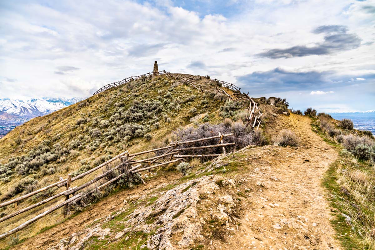
Though the Ensign Peak hike is very short, it packs a real punch in terms of beauty. It’s an out-and-back hike with stunning views from the top, and once you arrive at the summit, you’re rewarded with Salt Lake Valley and Great Salt Lake.
The path is well-maintained and a popular route all year long – you might be glad to hear that kids and dogs are able to hike this trail (dogs must be on a leash and cleaned up after).
We’ll warn you, though, during winter months or after heavy snowfall/ rain, parts of the trail can get slippery, icy, and/or muddy. Stay safe, friends!
Silver Lake Loop Trail
Length: less than 1 mile
Time: 20-30 minutes
Difficulty: Easy
Another one of the shorter hikes in Salt Lake City, the Silver Lake Loop takes you around – you guessed it – Silver Lake.
The path is very popular for families as part of the trail is a boardwalk and the other is hard-packed dirt. There are some elevated and uneven parts of the trail but it is generally considered to be wheelchair and stroller friendly.
Though this trail is short and easy, there is the potential risk of avalanches during the winter months. A simple check of the forecast before heading can give you warning levels.
The parking lot is paved and offers a number of designated spaces.
Broads Fork Trail
Length: 5.5 miles
Time: 4 hours
Difficulty: Hard
If you’re looking for a more advanced hiking trail near Salt Lake City, consider Broads Fork Trail.
This is another out-and-back hike that is popular all year long. But fair warning: Pets and young children should stay home as it is considered to be a challenging hike.
The trail is steep and rocky and follows a river that can get quite swollen after heavy rainfall or as snow begins to melt. During the winter months, the trail traverses through potential avalanche territory, so it’s always good to check conditions before heading out.
Broads Fork is a slightly more obscure hike so you may only run into a few other people on the route.
Better yet, it’s one of the shadier Salt Lake City hikes, making it a great option for those hot summer days.
Lake Solitude Trail
Length: 3.2 miles
Time: 1 hour, 30 minutes
Difficulty: Medium
The Lake Solitude Trail is an out-and-back trail type that most people consider semi-challenging. The trail is well maintained and many people use it year-round, but it’ is important to stay on the correct trail as other trails link up to it as well.
We’ll warn you that many people spot deer and moose along this trail and it is important to keep a distance and not interact with the wildlife. Admire from a distance!
Lake Solitude Trail has something special to offer each season of the year. Whether it’s the changing of the leaves during fall, the sparkling white of winter, or the enchanting wildflowers in the warmer months, this trek is said to be one of the greatest hikes near Salt Lake City.
Grandeur Peak Trail (West Face)
Length: 4.5 miles
Time: 4 hours, 45 minutes
Difficulty: Medium
Another great hike around Salt Lake City is the Grandeur Peak Trail. This trail is popular all year long for hiking and snowshoeing. It’s considered semi-challenging and covers a lot of different terrains so it’s important to have proper shoes for the season you’re hiking in.
Dogs are welcome on this trail but it’s probably best to leave small kids at home. It is quite steep the whole way up and can get pretty slippery during the winter or after rain.
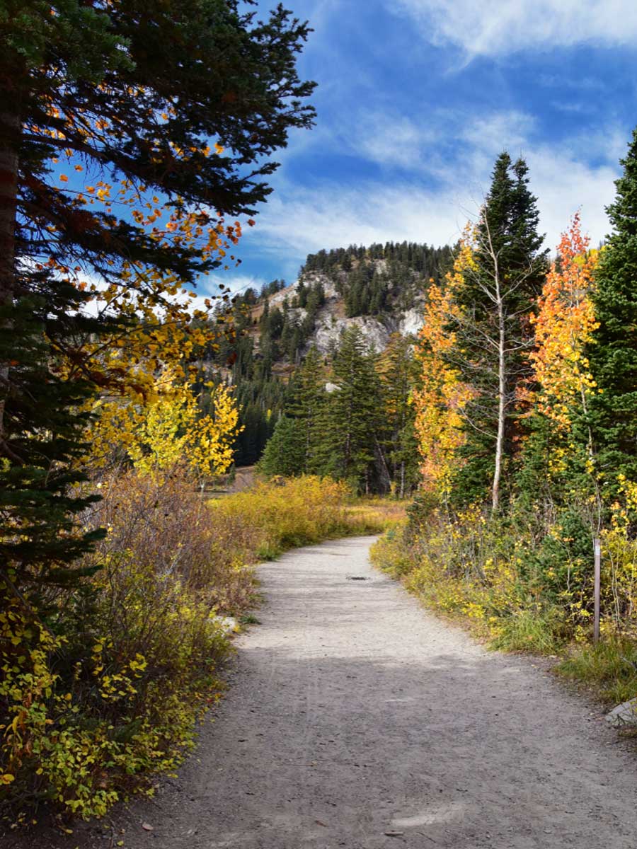
When’s best to hike this trail? Autumn, we think. You can see all the leaves change colors from different heights which makes for one of the best fall hikes near Salt Lake City.
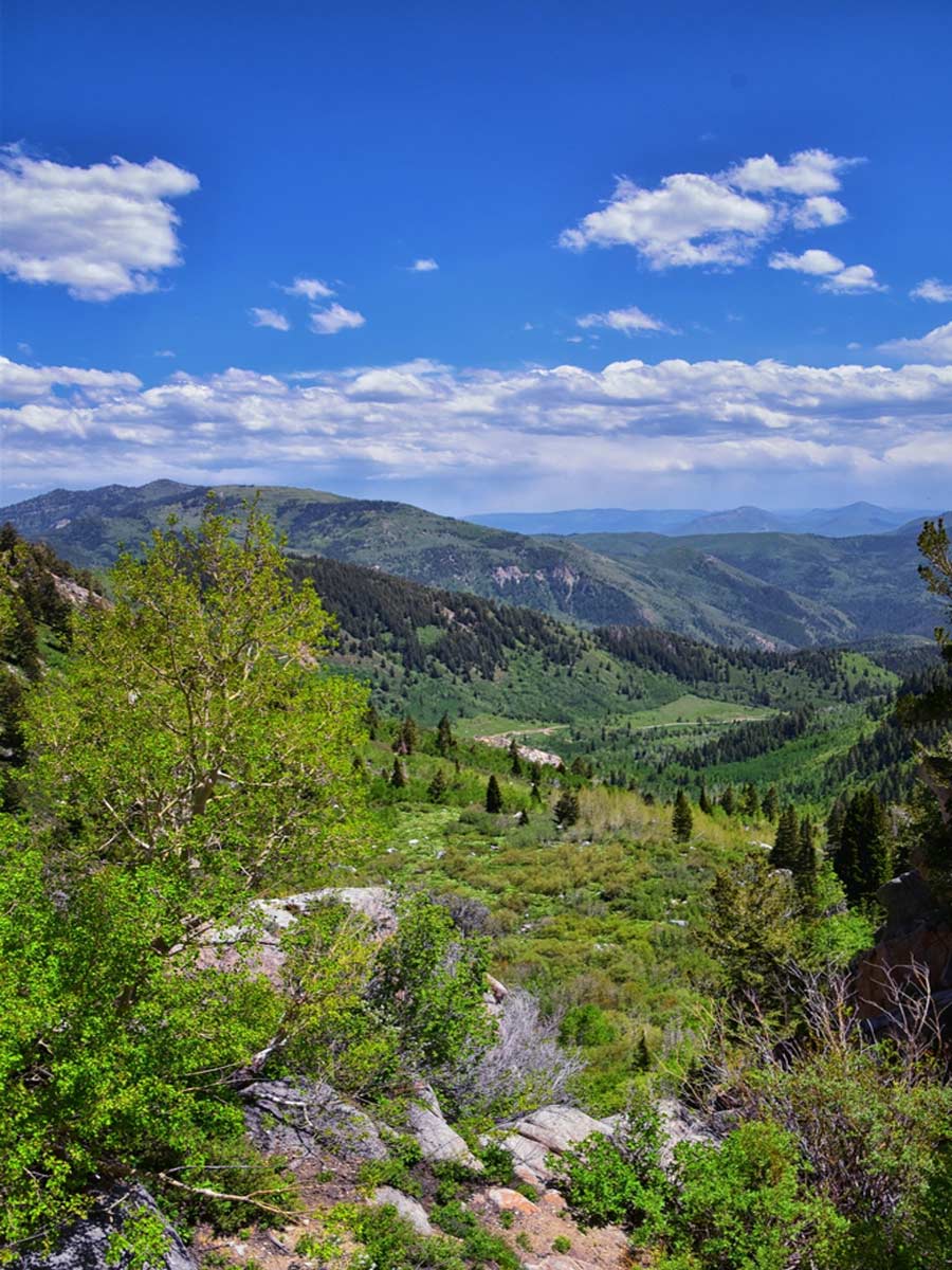
City Creek Canyon Trail
Length: 6.5 miles
Time: 2 hours, 45 minutes
Difficulty: Medium
City Creek Canyon Trail is one of the longer options on this list. But don’t let that put you off – the views are well worth it.
City Creek Canyon Road runs parallel to the trail and allows mountain bikes. Beware – although paved, it’s a very steep trail and is not wheelchair or stroller accessible.
Most people hike this trail from the months of April through October but it remains open throughout the year. The trail runs through meadows and streams with stunning views of the mountains.
There is limited parking at the trailhead so carpooling or getting there early is recommended.
Thayne Canyon Loop
Length: 1.5 miles
Time: 1 hour
Difficulty: Medium
Thayne Canyon Loop is one of the best trails near SLC. It’s on the shorter side, so it usually takes people less than an hour to complete.
It’s known to be one of the most beautiful hikes in all of Utah with views of rivers, mountains, forests, and meadows. It’s open all year long with limited parking at the trailhead.
The trail is well-marked and maintained, but dogs are only allowed on certain days and times and the best way to stay up to date with that information is here.
Sundial Peak Trail via Lake Blanche
Length: 10 miles
Time: 7 hours, 30 minutes
Difficulty: Medium
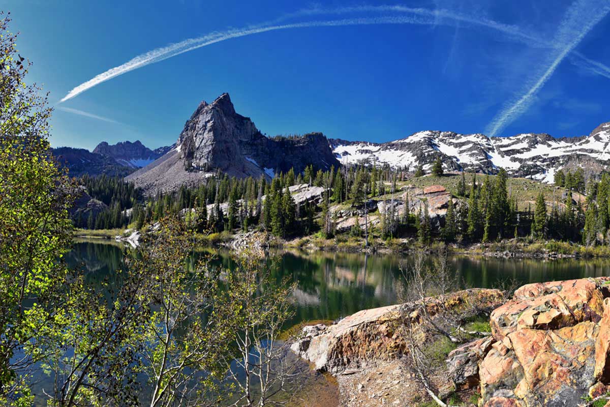
Another long hike, Sundial Peak Trail is considered by many to be one of the best trails in Salt Lake City.
Sad news – it’s not dog-friendly, because part of the trail requires scrambling. Oh, and during the winter, the trail goes through potential avalanche terrain.
It’s an out-and-back trail and, even though it is long, it is pretty manageable for most people. Moose have been spotted on and near the trail so it’s important to keep your eyes and ears open – be sensible, stay back, and we promise you won’t have any issues.
Since this trail is longer, leave early enough so you’re not hiking in the dark and know when it’s time to turn around, even if you haven’t reached the end of the trail or the summit.
Miller Park Loop
Length: Less than 1 mile
Time: 20-30 minutes
Difficulty: Easy
If you’re looking for easy hikes near Salt Lake City, look no further than Miller Park Loop. At less than a mile, this loop is ideal for anyone short on time or any newbies.
The highlights of this trail are the thick patches of trees and the babbling stream. Though parts of the trail are paved, there are several sets of steps, so it’s not totally wheelchair or stroller friendly.
There is a parking lot as well as street parking nearby.
Sugar House Park Loop
Length: 1.7 miles
Time: 45 minutes
Difficulty: Easy

Looking for an easy walk that doesn’t compromise when it comes to impressive views? Add the Sugar House Park Loop to your Utah itinerary.
Just shy of two miles, this loop is popular with runners, walkers, and bikers alike. It’s paved with painted lines dividing the lanes, making it wheelchair and stroller friendly. There is also plenty of free parking.
The path takes you around the lake with incredible views of the mountains and trees. Leashed pets are a common sight (dog-spotters will be in heaven) along with people rollerblading and skating. There are bathrooms, picnic tables, and pavilions all on site.
One downside to this walk is that it is also shared with cars, however, the loop remains a popular spot throughout the entire year.
Jordan River Parkway Trail
Length: 45.3 miles
Time: N/A
Difficulty: Medium
Looking for a real challenge? The Parkway Trail is a point-to-point multi-use trail that goes through several parks and neighborhoods – and sometimes runs along a river.
Of course, you don’t have to do the entire trail all in one go – many people do it in sections. We particularly love the segment that runs between Murray and Taylorsville.
Though the trail can be quite urban at times, there are also stunning views of the mountains, lakes, rivers, and more.
Dogs are welcome but must be leashed at all times along the trail. The path remains open all year long.
Salt Lake Overlook via Desolation Trail
Length: 4.8 miles
Time: 2 hours, 45 minutes
Difficulty: Medium
This challenging out-and-back trek is one of the better places to hike in Salt Lake City with your dog.
Dogs are allowed off-leash on odd-numbered days but must be kept on their leash on even-numbered days. We’re not quite sure why this system was put in place but it manages to be strictly respected.
Most people hike this trail between May and October but it is open all year long. During the winter months, people use this trail for snowshoeing. Described as well-maintained and well-marked, Salt Lake Overlook Trail utilizes switchbacks that bring you to a viewpoint overlooking SLC.
You can stop and turn back here or there is an option to continue to the end of Desolation Trail which goes on for another 18 miles.
Gobblers Knob via Alexander Basin Trail
Length: 4.5 miles
Time: 4 hours, 45 minutes
Difficulty: Hard
There are several ways to arrive at Gobblers Knob, but if you’re going via the Alexander Basin Trail, you can expect to be hiking for about 5 hours in total. It’s an out an back trail that is known to be steep for the majority of the route.
We recommend wearing sturdy boots for this hike as it can get rocky and slippery in certain areas. The trail is at its best from May to December and is typically a more quiet route. Dogs are welcome as long as they are on a lead.
Even though this trail can be strenuous, it is well worth the views once you reach the top and there are flat areas where you can rest along the way. Moose are known to frequent this trail so it is important to be aware of your surroundings, especially during mating season.
Salt Lake City Hikes: Practical Tips
To ensure you enjoy the best hikes in Salt Lake City follow these tips.
Hiking in Cold Weather
It goes without saying that staying warm and dry is vital – pack plenty of extra layers and wear thick socks to keep your toes toasty. Waterproof boots are always a good idea in case the weather turns miserable.
When hiking, always pick a time when you will turn back once it starts to get dark – please stay safe out on the trails. Bringing a flashlight and extra batteries is always recommended, too.
Hiking in Warm Weather
When hiking in the summer, start early to avoid the blaring mid day heat, and always bring more water than you think you’ll need. Dehydration is no joke.
Be aware of bears (particularly between April and November), moose, and other wildlife. Bringing bear spray/bells can also help protect you from grisly wildlife.