Ready to learn more about the best hikes in Escalante? Explore the famous treks and trails less traveled around this hidden gem in Southern Utah.
With a convenient location within an hour or two from some of the most famous landmarks in Utah, Escalante is a popular place to stay when visiting Zion, Bryce Canyon, and Capital Reef.
But to overlook the outdoor adventure in this small town is to pass up on some of our favorite hikes in Southern Utah. Really.
Home to Grand Staircase-Escalante National Monument, there are nearly 2 million acres of desert, shrublands, sandstone cliffs, and canyons waiting for outdoor enthusiasts of all levels to explore.
Ready for an adventure of a lifetime? Grab your hiking boots, and let’s hit the trails.
Best Hikes in Escalante
Dry Fork Narrows, Peekaboo Canyon, and Spooky Slot Canyon
Length: 6 Miles
Time: 4 Hours
Difficulty: Hard
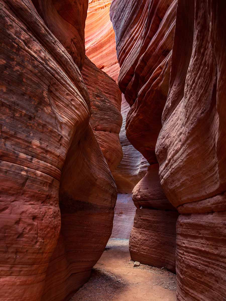
If you’re up for a challenge, you’ll experience one of the best Grand Staircase Escalante National Monument Trails, with rewarding views of two of the most IG-famous canyons in the park.
Dry Fork Narrows, Peekaboo Canyon, and Spooky Slot Canyon trail is a 6-mile out-and-back hike with 600+ feet of elevation change and plenty of scrambling and maneuvering involved.
If you’re an experienced hiker (or train beforehand, you’ll be fine. And these slot canyons’ incredible colors, patterns, and angles are well worth the effort.
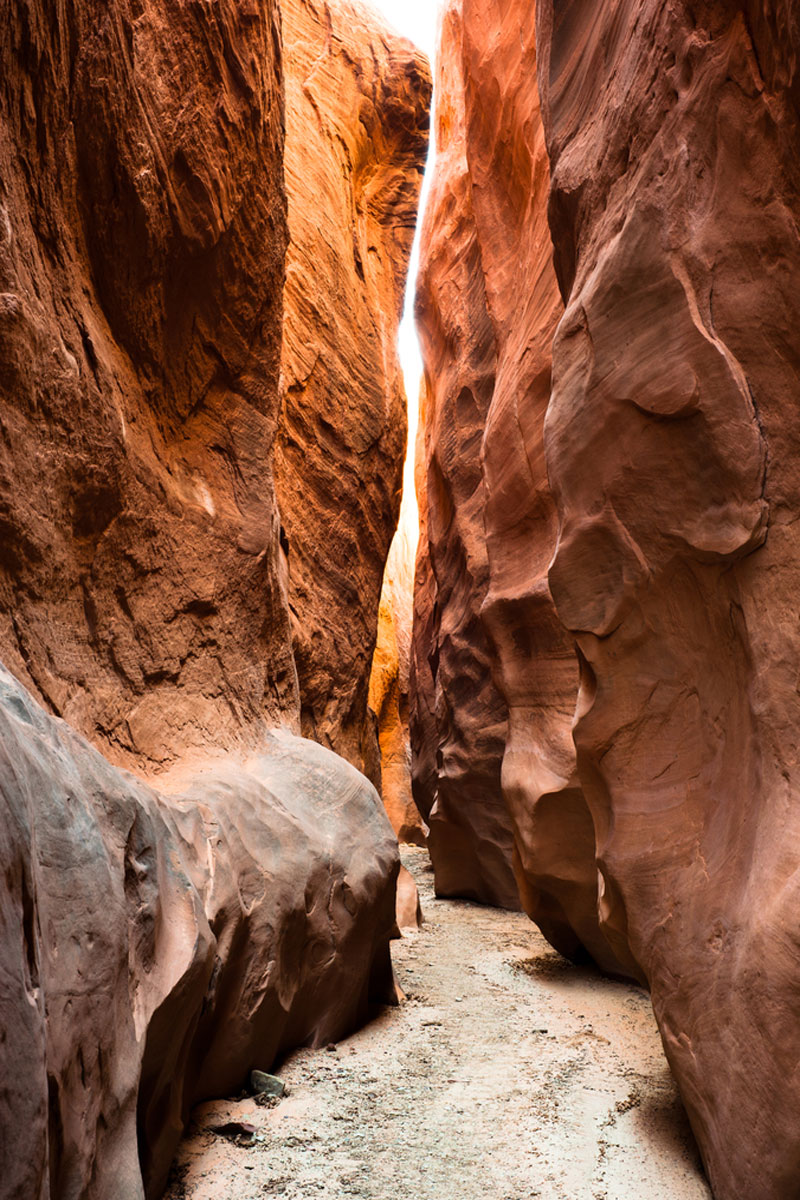
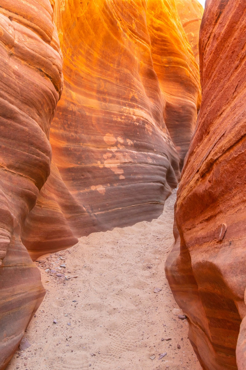
Zebra Canyon
Length: 5 Miles
Time: 2 Hours
Difficulty: Moderate
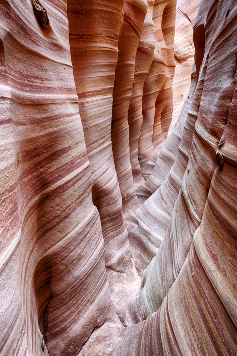
Speaking of the incredible canyon hikes near Escalante, Utah, Zebra Canyon is probably the most visually stunning of them all.
Trek the 5-mile out-and-back trail around sunrise and watch the light peek through the pink-ish sandy stripes in the narrow opening. It’s magical.
But be aware it’s common for water to fill up the small slot canyon, which can trap several feet of rain during the late summer months.
Still, it’s a fun hike with an epic payoff after an otherworldly desert landscape for much of the way there.
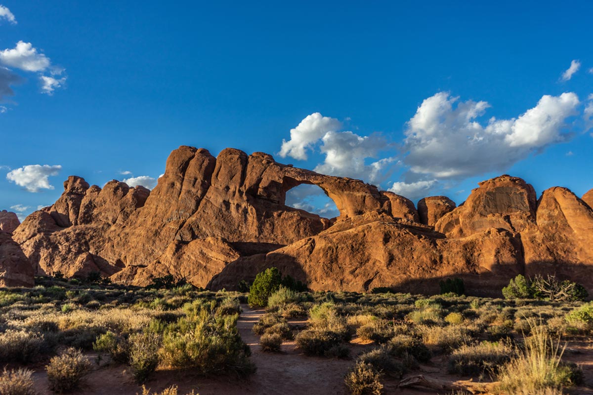
Devil’s Garden
Length: 0.4 Miles
Time: 20 Minutes
Difficulty: Easy
Take State Route 12 to Hole-in-the-Rock Road, and drive a long, bumpy 12 miles down the dirt road to reach one of the most scenic easy hikes in Grand Staircase Escalante.
Devil’s Garden boasts amazing hoodoos and the sweeping Landscape Arch that will likely keep you hanging around longer than you expect at one of the best day hikes Grand Staircase Escalante offers.
The trailhead is easy to find, and there are picnic tables and restrooms, making it an excellent choice for a mid-day hike or evening stroll.
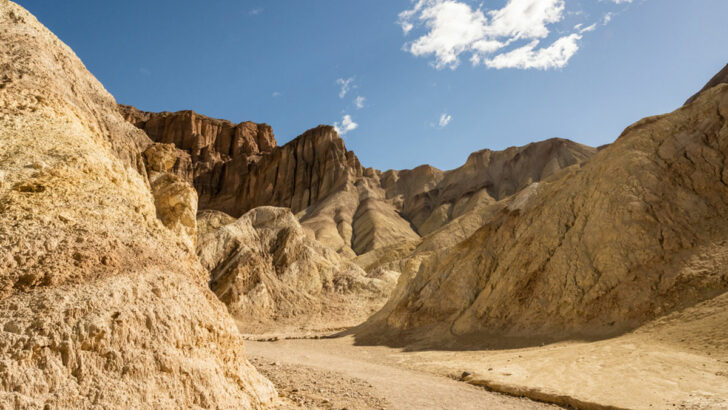
Bighorn Canyon Trail
Length: 6 Miles
Time: 3.5 Hours
Difficulty: Moderate
On your way to Devil’s Garden (or to break up the washboard drive back), add Bighorn Canyon Trail to your list of Grand Staircase Escalante hikes.
Not only is this Grand Staircase hike perfect for most average-level hikers, but the trails are also usually relatively quiet. This solitude gives you a chance to appreciate the two towering slot canyons with beautiful patterns naturally painted into the sandstone rocks.
Social trails make the main trail a tad confusing but follow the map below, and you should be ok.
Watch for snakes and apply lots of bug spray in the summer when hiking Escalante, Utah, on this remote trail.
The Golden Cathedral Trail
Length: 9 Miles
Time: 7 Hours
Difficulty: Hard
The Golden Cathedral Trail is one of the best hikes in Grand Staircase Escalante for outdoor enthusiasts with a knack for adventure and a penchant for patience.
Reaching the trailhead involves two long, rocky roads, the second of which (Egypt Road) will be pretty much impossible without 4WD.
Also, once you start one of the most famous Escalante hikes, you may notice cairns stacked up, warning you of steep drops below. There are river crossings, difficult (and sometimes confusing) sandy terrain, and the blazing Utah sun to deal with.
But all that said, if you muster up the courage and plan ahead, the sunshine illuminating the incredible openings of Neon Canyon easily makes this one of the most rewarding Grand Staircase-Escalante hikes.
Petrified Forest Nature Trail
Length: 1.9 Miles
Time: 1 Hour
Difficulty: Easy to Moderate
The Petrified Forest Nature Trail is a great choice if you’re looking for the best hikes near Escalante, Utah, for a casual stroll. Located in Escalante Petrified Forest State Park, you’ll notice some of the namesake ancient trees when you pull into the parking lot at the trailhead.
Once you begin your Escalante, Utah hiking, you’ll experience rocky terrain, beautiful views, and more wildlife than people.
It’s a nice change of pace to pair with the best Grand Staircase Escalante hikes nearby and easy enough for most hikers to handle.
Lower Calf Creek Falls
Length: 6 Miles
Time: 2.5 to 3 Hours
Difficulty: Moderate
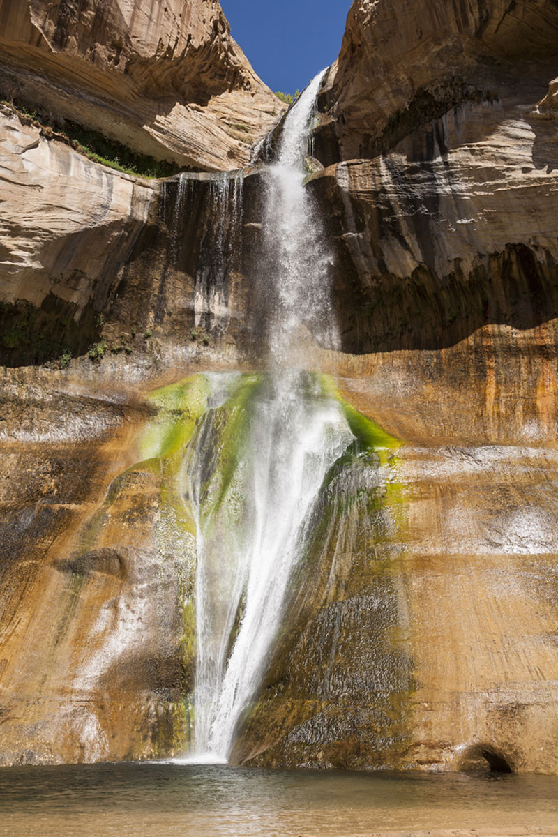
Lower Calf Creek Falls is one of the most famous Grand Staircase Escalante National Monument hikes famed for its beautiful canyon pathway leading to stunning waterfalls and best seen in the fall.
Located about 15 miles from Escalante off State Route 12, you’ll start your hike near the Calf Creek Recreation Area campgrounds.
The out-and-back trail only has around 530 feet of elevation change over 6 miles, but you’ll want to allow lots of time for pictures of the ancient petroglyphs and 126-foot falls. Grab a trail map and bring your swimsuit for a refreshing cool-down mid-hike.
Upper Calf Creek Falls
Length: 2.1 Miles
Time: 1.5 Hours
Difficulty: Moderate
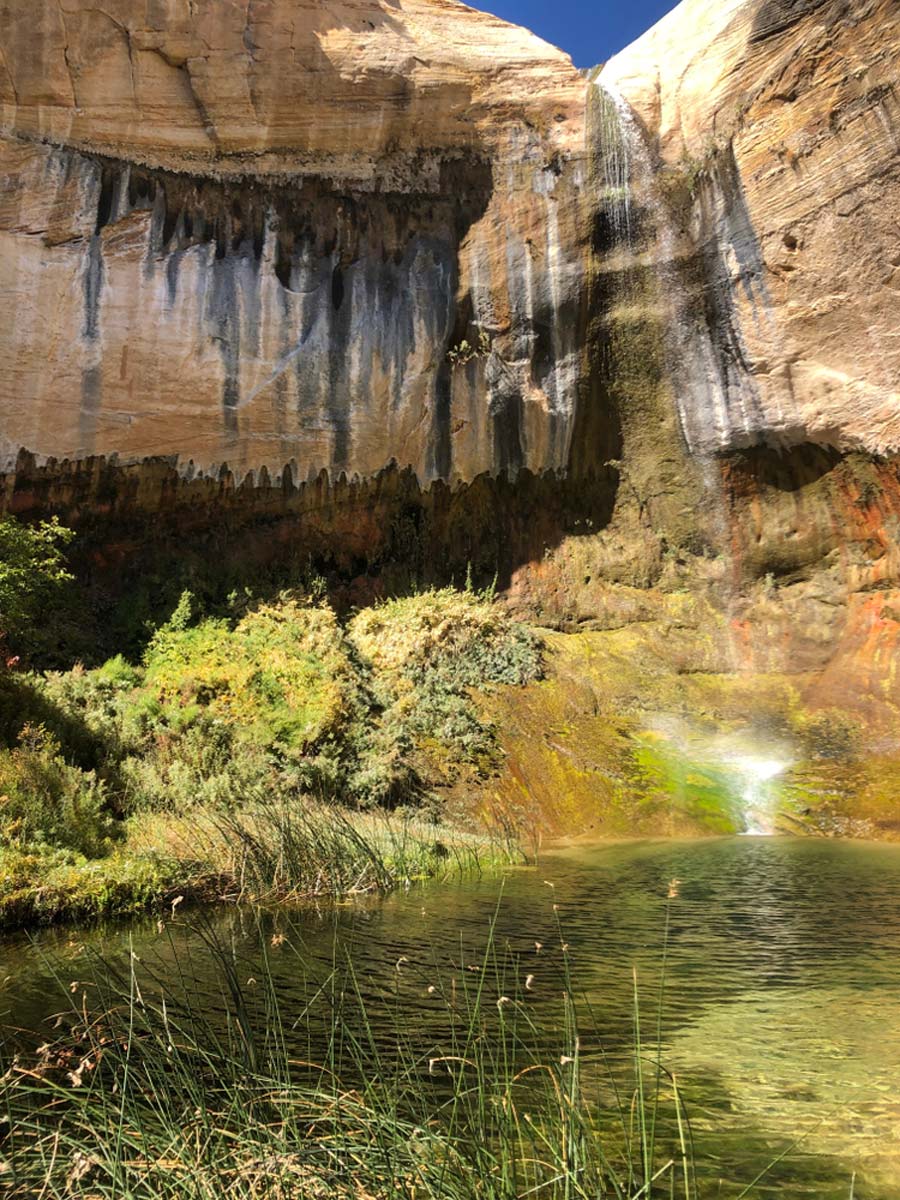
Also beginning at the Calf Creek Campground, Upper Calf Creek Falls manages to stay under the radar compared to its more famous sibling.
Probably because it’s a steeper trek, the trails here aren’t nearly as crowded, so you can take in the towering waterfalls peacefully and enjoy the cold water splashing down near the swimming holes on a hot Utah summer day.
Trails are mostly well-marked, but you’ll want to pack ample water, especially if you hike later in the day.
Phipps Arch Trail
Length: 6.4 Miles
Time: 4 Hours
Difficulty: Moderate
Looking for Grand Staircase Escalante dog-friendly hikes? Head to Phipps Arch Trail along State Route 12, about 20 minutes outside Escalante, for this moderately challenging out-and-back trail.
You’re in the right place if you’re after scenic Escalante Grand Staircase hikes. Trails are a little unclear due to social trails leading off in different directions, and you’ll need to hike some steep canyon inclines.
But the payoff of the massive sandstone walls contrasting with the noticeably small opening of the natural bridge make Phipps Arch Trail one you’ll want to save on your map of Grand Staircase Escalante hikes.
Escalante Natural Bridge
Length: 4.4 Miles
Time: 1.5 to 2 Hours
Difficulty: Easy
About a 15-minute drive from town is one of the most famous hikes in Grand Staircase Escalante.
The Escalante Natural Bridge trail takes you through a beautiful canyon section where you’ll see petroglyphs etched in the sandstone cliffs, cross gently flowing rivers more than once, and finally hit the payoff – Escalante Natural Bridge.
There are actually two natural bridges on this hike. But the 130-foot red rocks forming a natural gateway through the South Utah desert are the most memorable part of one of the most famous easy hikes in Grand Staircase-Escalante.
Boulder Mail Trail
Length: 15.1 Miles
Time: 12
Difficulty: Hard
Head south on State Route 12, and you’ll reach the Boulder Mail Trailhead in around 30 minutes.
You’ll walk the 15-mile point-to-point trail across several canyons, Sand Creek, and around the natural bridge near Mamie Creek from Boulder back to Escalante.
This grueling journey can be quite dangerous in the summer due to the sweltering heat and flash flooding. So plan your trip well in advance, and alert friends and family when attempting this epic trek in Escalante.
We suggest hiring an Uber to drop you off and hiking from Boulder to Escalante on a 2-day itinerary.
Escalante Hikes: Practical Tips
- You can enjoy the best hikes Grand Staircase Escalante offers free of charge, but you’ll need to reserve and pay for most campgrounds beforehand.
- If hiking in the morning or evening, be aware of bears, especially in shrubs and trees. Plenty of black bears are around Escalante, but you can find bear safety tips here.
- Mountain lions are also relatively common in Escalante. If you see one, practice standard safety protocol.
- Bring hiking shoes with good traction; some of the trails are a little rough.
- Pack water, sunscreen, sunglasses, and a hat for the desert sun.
- The best time for most Escalante, Utah hikes is May and October.
- Most of these hikes are in remote areas like off Hole-in-the-Rock Road, where you won’t have cell phone reception, so you’ll want a compass or GPS.
- Slot canyons can be very dangerous during the rainy season when flash flooding fills up Grand Staircase Escalante slot canyon hikes quickly.